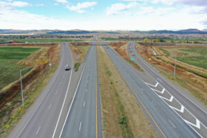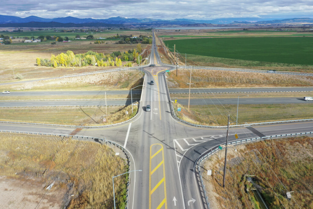
The Montana Department of Transportation (MDT) initiated this project to improve the congested Lincoln Road Interchange six miles north of Helena, Montana on Interstate 15 (I-15). RPA provided holistic professional civil engineering and land surveying services spanning from preliminary traffic engineering analysis and concept development through final design and construction assistance.
Problem
The north valley outside of Helena has experienced rapid growth due to development activity and changes in land use. Construction of the Custer Interchange six miles to the south also resulted in unanticipated changes to traffic patterns and operations at the Lincoln Interchange. Traffic performance deteriorated as traffic volumes increased. This area has experienced vehicle congestion during the peak hours and is expected to experience increased growth in the coming years due to continued development. If remained unchanged, increasing vehicle delay and safety issues were likely to compound. A successful solution was needed to accommodate peak traffic while not unduly delaying motorists during less congested times of the day.
Solution
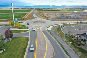
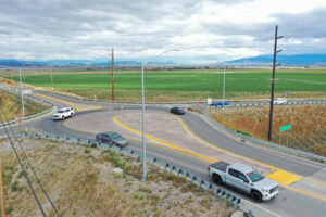
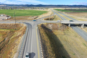
RPA completed a traffic engineering study to identify and evaluate potential options to improve safety and operations for the Lincoln Road corridor between North Montana Avenue and I-15. The alternatives were intended to be implementable in the short-term and did not include full reconstruction of the Lincoln Interchange or the Lincoln Road corridor. Potential barriers and constraints to project development were also identified to evaluate the feasibility of alternatives. The preferred alternative included single-lane roundabouts at the Lincoln Road intersections with Montana Avenue and the I-15 northbound off-ramp, an additional southbound on-ramp lane, and left-turn lane onto the southbound on-ramp.
Key Project Elements
- Safety project with the replacement of two intersections with roundabouts and the addition of I-15 ramp lanes
- Performed initial feasibility study and alternatives analysis with multiple geometric options
- Implemented broad public relations campaign that overcame public resistance to the improvements
- Designed PCCP single-lane and PMS tear-drop roundabouts
- Coordinated with the irrigation district for siphon extension, structure replacement, and specialty safety cable system
- Investigated future roundabout metering to extend roundabout life
Project Details
Client
Montana Department of Transportation (MDT)
Location
Lewis & Clark County, Montana